
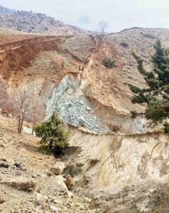
On Feb. 6, 2023, a devastating earthquake sequence occurred within the East Anatolian fault system. A Mw 7.8 earthquake struck at 4:17 a.m. local time approximately 35 km northwest of the city of Gaziantep in south-central Türkiye. This earthquake was followed by a second large magnitude earthquake of Mw 7.5 at 1:24 p.m. with the epicenter near the city of Elbistan, approximately 85 km north of the earlier earthquake epicenter. Both events occurred at 10 and 15 km depths, respectively, and resulted in significant left lateral, strike slip surface rupture along two distinct traces of the East Anatolian fault system. The LCI Research Program supported Principal Engineering Geologist Kevin Clahan to co-lead the Geotechnical Extreme Events Reconnaissance Association, GEER, reconnaissance efforts of the two events. In total, the geologic reconnaissance teams observed over 300 km of fault surface rupture and mapped nearly 80 km of the ruptures in detail. Left-lateral surface displacements along the Mw 7.8 East Anatolian fault rupture were remarkably consistent, 3 to 4 m, but diminished to the south near Antakya to around 0.5 m. The lesser Mw 7.5 event produced the largest recorded surface displacements of consistent 7 to 8 m of left lateral offset with the largest recorded displacement measuring 8.6 m.