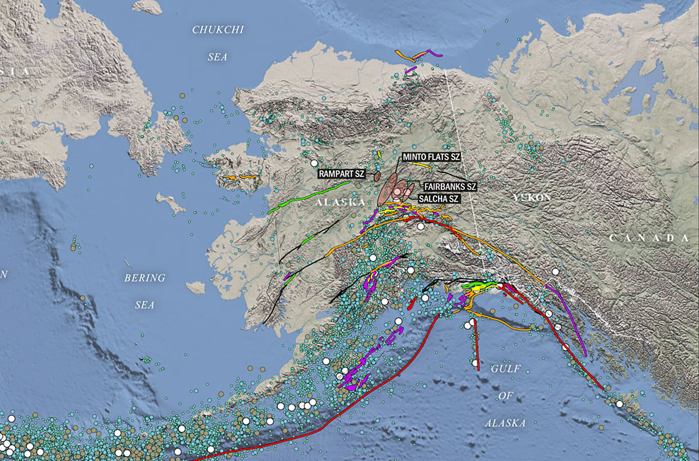
 LCI professionals have expertise in Geographic Information Systems (GIS), Information Management (IM), and Information Technologies (IT) projects. LCI staff have expertise in a wide range of GIS practices including 4D GIS mapping, analysis, scientific visualizations, animations, remote sensing, drone imagery, digital elevation models, LiDAR, InSAR, multibeam bathymetry, seismic reflection, and radar data analysis. The LCI GIS team has managed databases for several high-profile projects funded by the U.S. Nuclear Regulatory Commission, U.S. Department of Energy, Electric Power Research Institute, and commercial clients such as oil & gas industries, power generation, and transmission companies.
LCI staff have extensive experience combining detailed geologic mapping with the latest GIS mapping software to develop state-of-the art mapping solutions. LCI specializes in integration of geologic and geospatial data to develop comprehensive project databases.
Our capabilities in (GIS) Applications include:
- 4D GIS analysis and interpretations
- Scientific visualizations and animations
- Drone imagery and data processing
- Remote sensing interpretation and analyses
- Aerial photography
- Satellite imagery
- Web-based map publishing
- Interferometric Synthetic Aperture Radar (InSAR)
- Light Detection and Ranging (LiDAR)
- Multichannel Seismic Reflection (MCS)
Our GIS capabilities include comprehensive database management for large multi-year projects. LCI has extensive experience in compiling and integrating geospatial data as part of SSHAC Level III or similar studies. Below is a list of recent GIS, database, and IM projects that have been completed by LCI professionals:
- GIS & Database Management Services Central and Eastern United States Seismic Source Characterization (CEUS SSC) Project
- GIS & Database Management Services for BC Hydro SSHAC Level 3 Seismic Source Characterization Project
- GIS & Database Management Services for Diablo Canyon SSHAC Level 3 Seismic Source Characterization Project
- GIS & Database Management Services for EPRI (2004, 2006) Ground-Motion Model (GMM) Review Project
- GIS, Database and Information Management Services for Thyspunt, South Africa SSHAC Level 3 seismic hazard study
- Graphics, Database and Information Management Services, for Diablo Canyon Nuclear Power Plant
- Probabilistic Fault Displacement Hazard Analysis for Offshore Facilities
- GIS Analysis for the Fault Displacement, and Tsunami Hazard Assessment, Papua New Guinea LNG Pipeline Project, Papua New Guinea
- GIS Analysis for Dam Break Inundation Mapping for Martis Creek Dam, Nevada County, CA
Aerial Imaging / Drone Services
The LCI drone services group captures high resolution aerial images and utilizes professional photogrammetry software to turn aerial images into highly precise, georeferenced 2D maps and 3D models. LCI’s drone images services are highly customizable, timely, and complement a wide range of projects and client needs:
- Orthomosaic Basemap Production: A high resolution map with each pixel of the original images correctly projected onto the digital surface model, leaving only accurate geolocation and no perspective distortions.
- 3D Point Cloud: 3D point cloud derived from overlapped images gives the accurate location in the reconstructed object space, displayed in original RGB or classification colors.
- Digital Surface & Terrain Model: Digital models that give the elevation value of each pixel, with or without above-ground objects, ready for preferred GIS workflow.
- Volume Calculation: Output calculated volumes on a perfect representation of stockpiles, with fully-adjustable base height which leads to precise measurements.
- Contour Lines: Generate a simplified representation of topography with closed contours displaying the elevation.
- 3D Textured Model: Full 3D triangular mesh with photorealistic texturing, available also in level-of-detail formats, perfect for sharing and visualization.
- Change Detection: This process measures how the attributes of a particular area have changed between two or more time periods. Change detection can be used to identify a new feature over time, feature’s location over time, feature’s shape over time or feature’s size over time.
